
Offline Maps for Armenia's Roads: A Renter's Guide
Before renting a car in Armenia, download the offline map for your entire route, save the key addresses, and keep a backup — mobile coverage often fails on mountain roads.
8 min read
In this article
To plan a route by car in Armenia, download the offline map covering your whole route before you leave, save the key addresses and points on your device, and keep a backup (a printed map) — mobile coverage is often weak in mountain regions.
Why an offline map is essential in Armenia
An offline map isn't optional in Armenia — it's basic preparation. Much of the country's road network runs through mountain terrain where cell coverage comes and goes. Typical examples are high mountain passes, remote rural roads, and long stretches toward Tavush, Syunik and Gegharkunik. On any of them, an online navigator can simply "forget" where you are.
Coverage isn't the only problem. In tunnels, gorges and forested sections, GPS may keep working while the map data doesn't — without a downloaded area, all you see is an empty grid. And for foreign renters, activating a local SIM takes time, while roaming is expensive.
As a JanCar editor, I'd suggest treating the download as routine a step as walking around the car before you drive off. Five minutes of preparation saves hours on the road.
Step by step: how to download the offline map
Downloading an offline map takes three steps: pick the area, check storage and expiry, then test it in airplane mode. The steps below work in nearly every modern navigation app. For example, to download Armenia's offline map in Google Maps, open the app, tap your profile picture, choose "Offline maps" → "Select your own map", trace the area along your route manually and tap "Download"; details are published on Google's official Maps Help pages (verified as of 2025). Other popular navigators offer similar features, so the choice is yours.
Step 1: choose the area along your route
Download not just the destination but the whole "corridor" of your route — from start to finish, including nearby major cities. If you're planning a loop (say Yerevan → Sevan → Dilijan → Yerevan), trace the entire ring. Leave a reserve corridor too, along a secondary direction parallel to the main road: if the highway closes, you'll still be able to orient yourself.
Step 2: check storage space and the update window
Some apps let you store the offline map on an SD card so it doesn't eat into your phone's internal memory. Pay attention to the expiry period: many apps keep offline data only for a limited time (often 15–30 days), after which they require a refresh — which needs connectivity. For the whole rental period, download the map shortly before departure, not weeks ahead.
Step 3: test it in airplane mode
The day before you leave, switch on airplane mode and open the navigator. Enter the route from the rental handover point to your hotel and make sure the map shows the road, street names, and can build a route. If the screen shows an empty background, the download didn't work — better to find that out at home than after leaving Zvartnots airport.
What to save on your device: addresses and key points
Save the handover point, your hotel, fuel stations and emergency services as pinned locations. This matters because search often doesn't work offline; only pre-saved points do.
- Handover point: the rental address — for example, the meeting point at Zvartnots International Airport or the owner's specified spot in town.
- Lodging: the exact pin of your hotel or apartment — not the street name, the entrance itself.
- Fuel stations: 2–3 stations from major chains along your route, especially before long mountain stretches.
- Emergency numbers: Armenia's unified emergency number is 112 (verified as of 2025); save it in your contacts as text too, so you can find it without internet.
- Owner's contact: your rental host's phone number — saved in contacts, not buried in chat history.
This list complements navigation but doesn't replace it: if the device dies, you should be able to find your way with a paper option too.
Your backup when there's no signal in the mountains
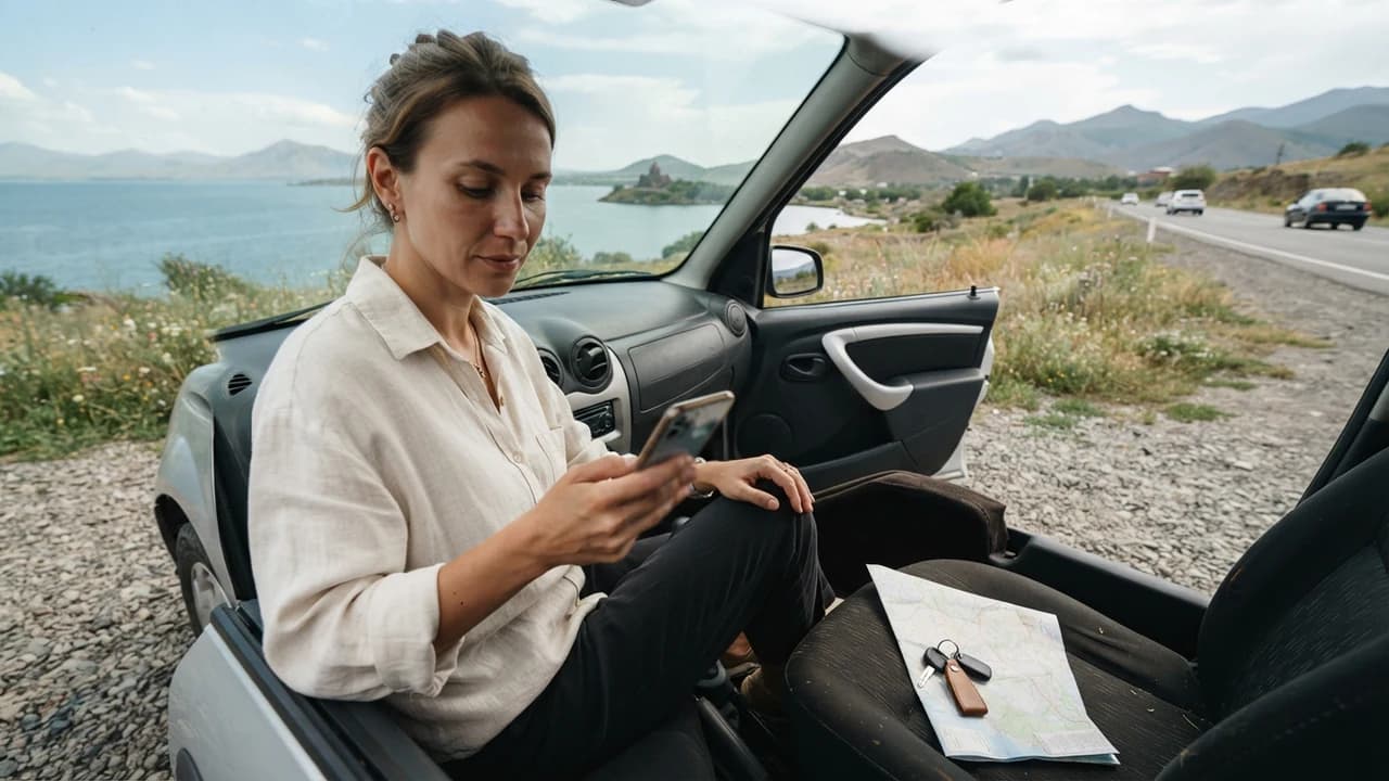
When there's no cell coverage in Armenia's mountains, work in three layers: a downloaded map, a printed map, and road signs. GPS keeps working without internet on a downloaded map, so your position usually still shows. A printed road atlas is the most reliable backup for long routes — it never runs out of battery and never freezes.
- Charging: bring a power bank and a car USB charger; navigation drains the battery fast.
- Road signs: Armenia's main highways carry M-prefix numbers (M1, M4 and so on); mark those numbers on your printed map when planning.
- The stop-and-ask rule: if you're lost, pull over somewhere safe and ask locals — in rural areas this is often the fastest "navigator" there is.
- Road conditions: before departure, check route status from official sources — announcements from the Police of Armenia (roadpolice.am) and the government (gov.am), especially in winter (verified as of 2025).
Common mistakes and main risks
The most common mistakes: no downloaded area, an expired map, a dead battery, and relying on a single app. Each one takes a minute to prevent.
Mistake
Consequence
Prevention
No downloaded area
Blank screen in the mountains
Download the whole route corridor
Expired map
App demands an update
Download shortly before departure, not earlier
Dead battery
No navigation, no calls
Power bank + car charger
Single app
One failure stops the trip
A second app or a printed map
One separate risk is trusting an old map: due to road reconstruction, some sections change. Before a long trip, check for traffic changes from the police's official source on the day you leave.
JanCar's role and what to confirm in advance
JanCar is a marketplace connecting renters with independent owners: the car, price, deposit, insurance and handover terms are set by the listing, the owner and your agreement. The platform does not provide navigation services and bears no responsibility for map data.
To be clear about deposits: JanCar does not receive, block or hold a security deposit. If a listing states one, its amount and handling are arranged directly between you and the owner. Likewise, confirm insurance coverage from the listing and ask to see the policy at handover.
Before departure, run this final checklist too:
- The entire route area is downloaded (for loops, the whole ring).
- The map has been tested in airplane mode.
- The handover point, hotel, fuel stations and 112 are saved.
- The owner's number is in your contacts.
- You have a power bank or car charger.
- For long trips, you have a printed map.
- Road status checked on departure day via roadpolice.am.
The next step is simple: plan your route before renting a car, so you pick the right type of vehicle and include the handover point on your map. Compare real cars and owners' terms on JanCar — without expecting any oversold promises.
Frequently asked questions
How do I download Google Maps offline for Armenia?
Open Google Maps, tap your profile picture, choose "Offline maps" → "Select your own map", trace your route's area and tap "Download". Refreshing the map requires periodic connectivity, so download it shortly before departure (verified as of 2025).
What should I do when there's no cell coverage in Armenia's mountains?
Work with the downloaded map — GPS keeps showing your position without internet. Carry a printed map and a charged battery, navigate by M-numbered highways, and if needed call 112 at the first point where coverage returns.
Does an offline map replace checking road conditions?
No. The map shows the route, but not closures, repairs or winter restrictions. Check those on departure day via official sources from the Police of Armenia and the government.
Related reading
Continue with these verified related guides.
This is general information. JanCar does not receive or hold a vehicle deposit. Check price, deposit, insurance and every other term on the listing and directly with the owner.
More JanCar guides
Continue with these closely related practical guides.
- Engine Braking on Mountain Descents: A Practical Guide
- Reviewing a Renter After Car Return
- How to Calculate a Car Rental Mileage Limit, Step by Step
- Road Signs & Markings in Armenia: A Foreign Driver's Guide
- Filling Up a Rental Car in Armenia: 4 Simple Steps
- Camping by Car in Armenia: A Renter's Checklist
Frequently asked questions
How do I download Google Maps offline for Armenia?
Open Google Maps, tap your profile picture, choose "Offline maps" → "Select your own map", trace your route's area and tap "Download". Refreshing the map requires periodic connectivity, so download it shortly before departure (verified as of 2025).
What should I do when there's no cell coverage in Armenia's mountains?
Work with the downloaded map — GPS keeps showing your position without internet. Carry a printed map and a charged battery, navigate by M-numbered highways, and if needed call 112 at the first point where coverage returns.
Does an offline map replace checking road conditions?
No. The map shows the route, but not closures, repairs or winter restrictions. Check those on departure day via official sources from the Police of Armenia and the government.
Where to go next
Sources
- JanCar — how it works
jancar.am · official source
- JanCar car catalogue
jancar.am · official source